Lori and I had been talking about another adventure on the Appalachian Trail leading up to our races in June. We
have done many parts of the AT, including some of the PenMar sections last year. I went out and attempted the
4-state challenge last May. Unfortunately, the heat and lack of water did me in at mile 31 at Gathland State Park.
I was determined this year to go further.
After sharing this idea with Dylan at a Feet First Fun Run, he decided he and our friend Josh would join. Heather
is training for a big race that required a training camp weekend totaling 100 miles over 4 days, so she joined us as
well.
We all decided we would start together at PenMar and head south towards Harpers Ferry. Dylan‘s wife Megan had
agreed to meet us somewhere along the route with fuel food and two very energetic boys to help!
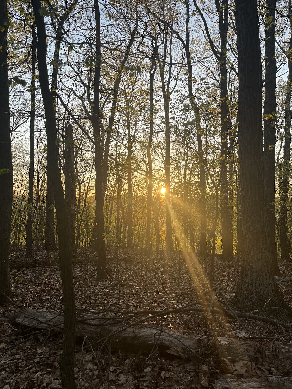
The weather was perfect. It was 53° at the start and would climb up to 68° by the peak of the day. A light breeze
in the afternoon would lead us into a cool evening.
Friday, 11:37pm
After a super fun night at Battle of the Books, I set my alarm for 4:00am and went to bed.
I tossed and turned most of the night, as I do. Luckily, I sleep banked many hours this week in preparation for a
weekend of a lot of fun and not a lot of resting. “YOU’LL SLEEP WHEN YOU’RE DEAD!!!”
Jumped out of bed after having a dream where I had to wake up super early. So basically I was worrying in 2
worlds :) I made some coffee, packed my gear and food in my hydration pack.
Food: 3 PB&Js, 2 sweet potato avocado burritos, peanut m&m, date & coconut bites, banana, 2 eggs, 2 Gu, 1
bottle of Gnarly, Salt Chews, salty mix of pretzels and dill pickle cashews, 2 apple sauce packets, 2L of water.
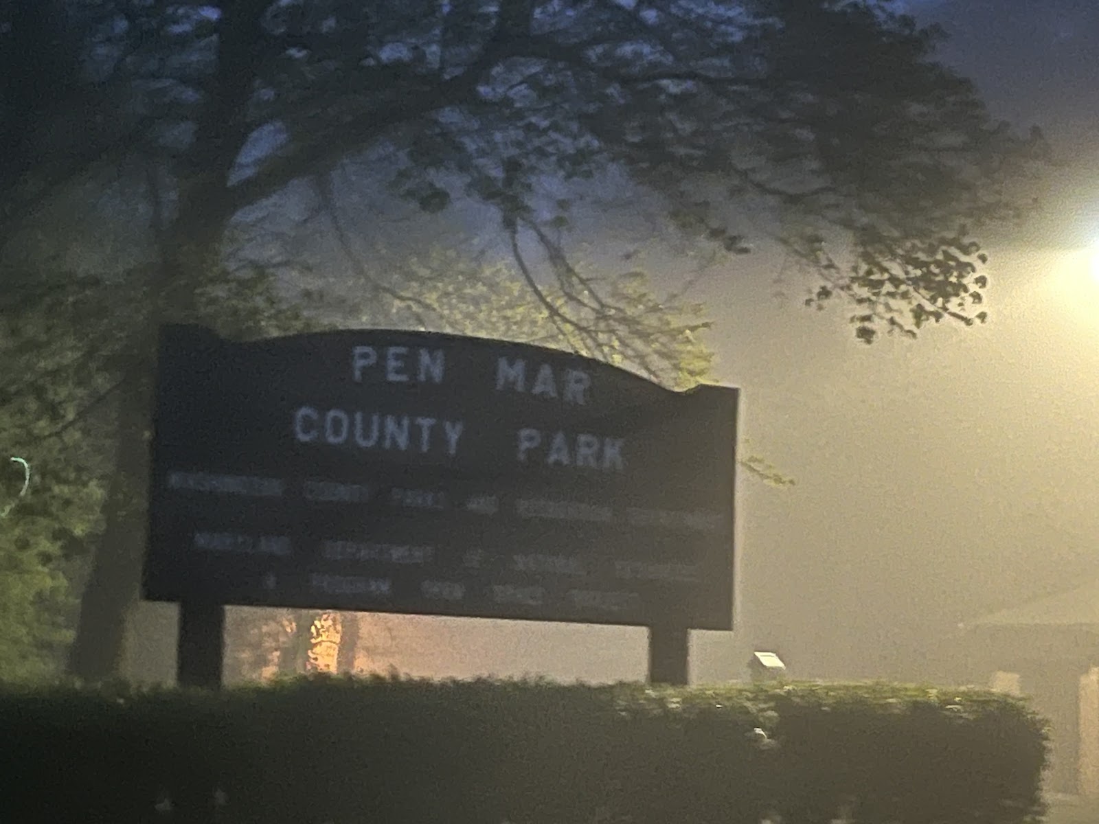
4:30am
Heather, Lori and I met at Meadowbrook Park & Ride. They put all of their gear in my car and we took off to
PenMar Park to meet Dylan and Josh. About a mile before we reached the park, near Fort Ritchie, it became
incredibly foggy. It was almost to the point where we could not see where we were going, and I had a lot of
trouble finding the parking lot. Fortunately, I could see Dylan‘s car lights.
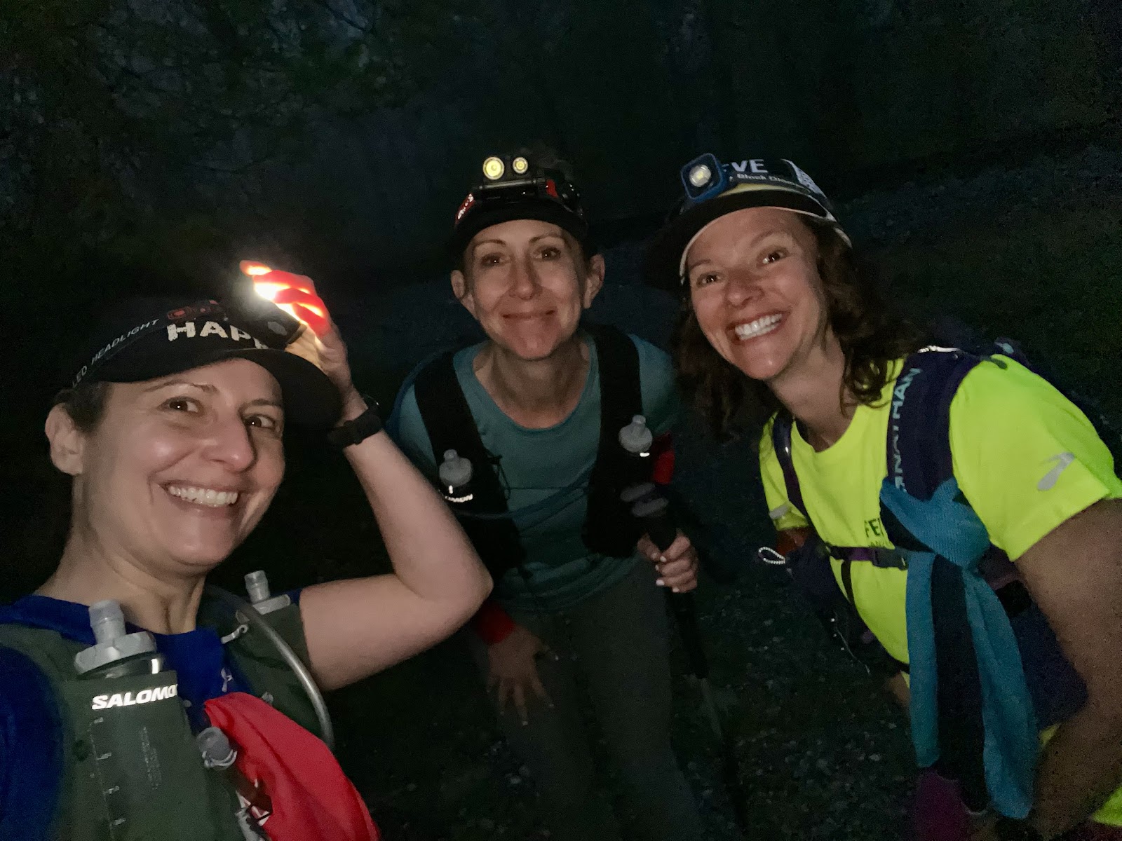
5:59am - Press “Start” and go.
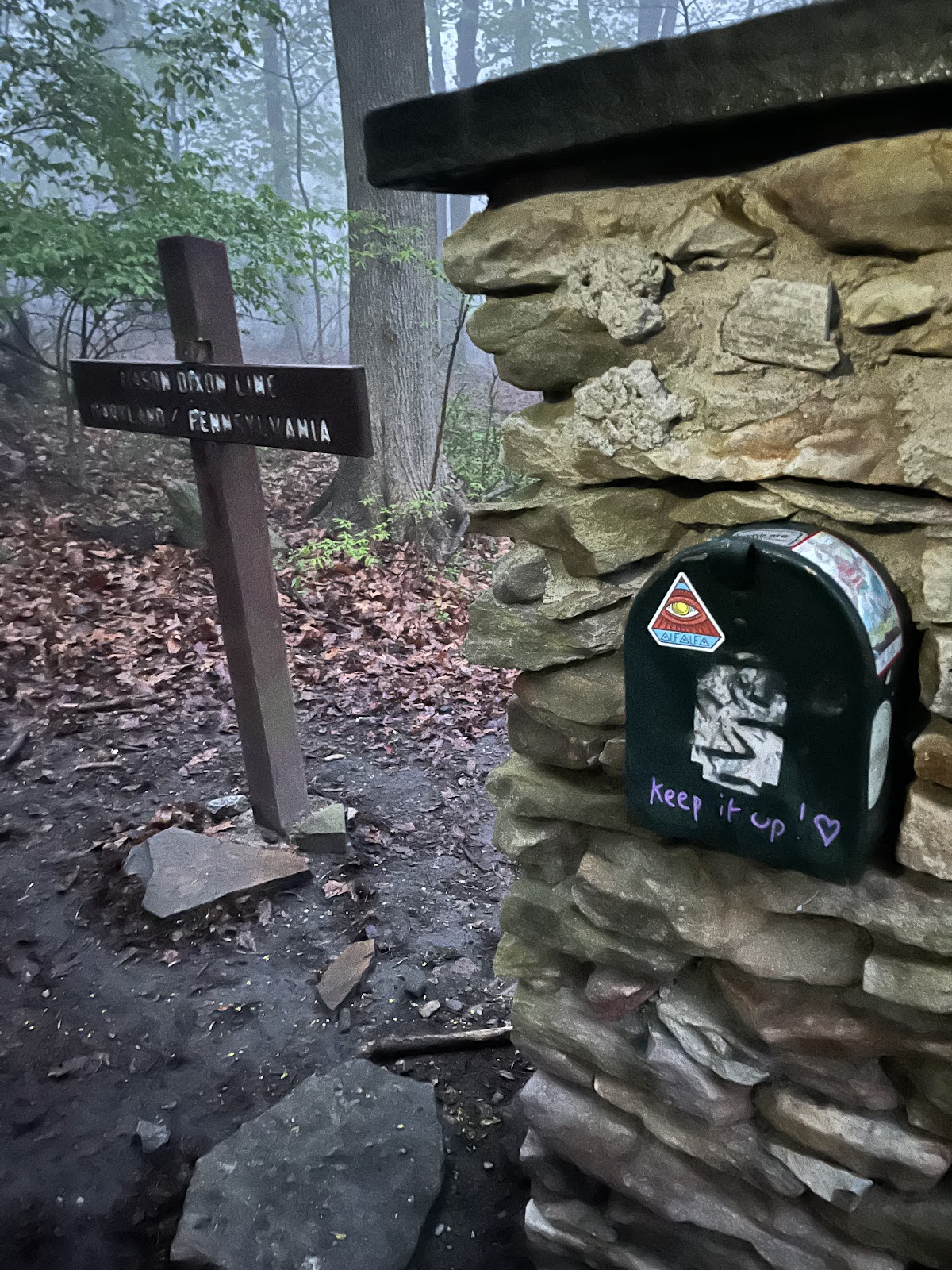
We decided we were going to travel about a quarter of a mile north to hit the Mason Dixon line to step foot in
Pennsylvania.
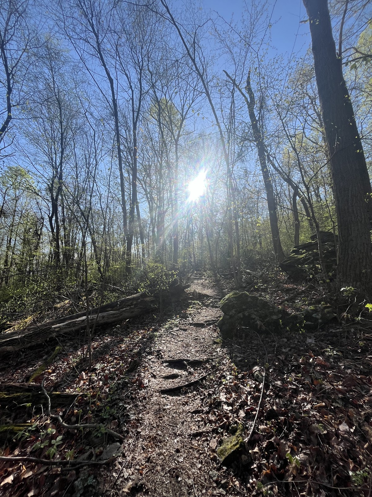
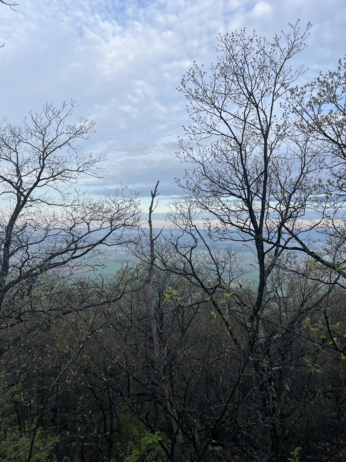
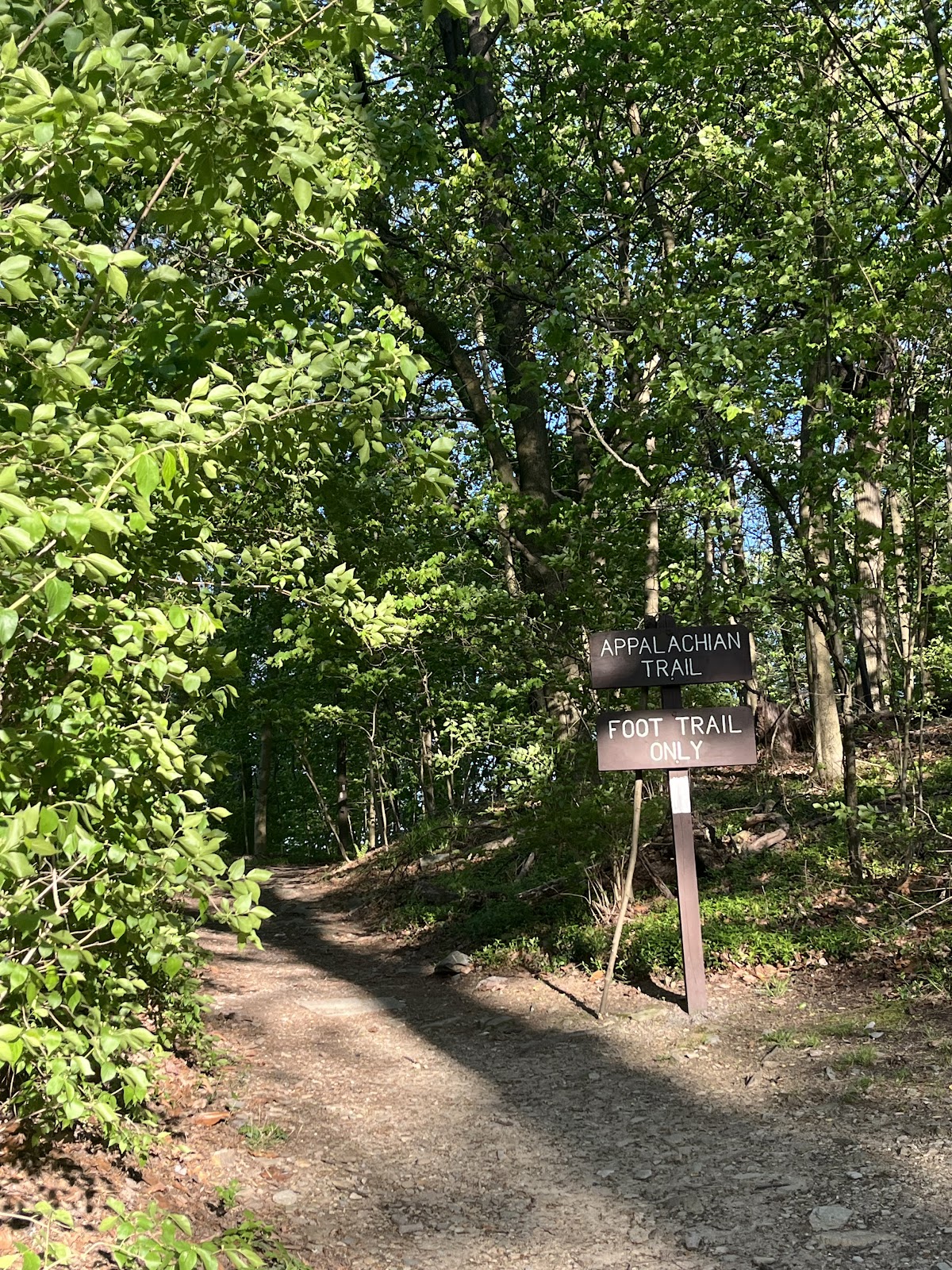
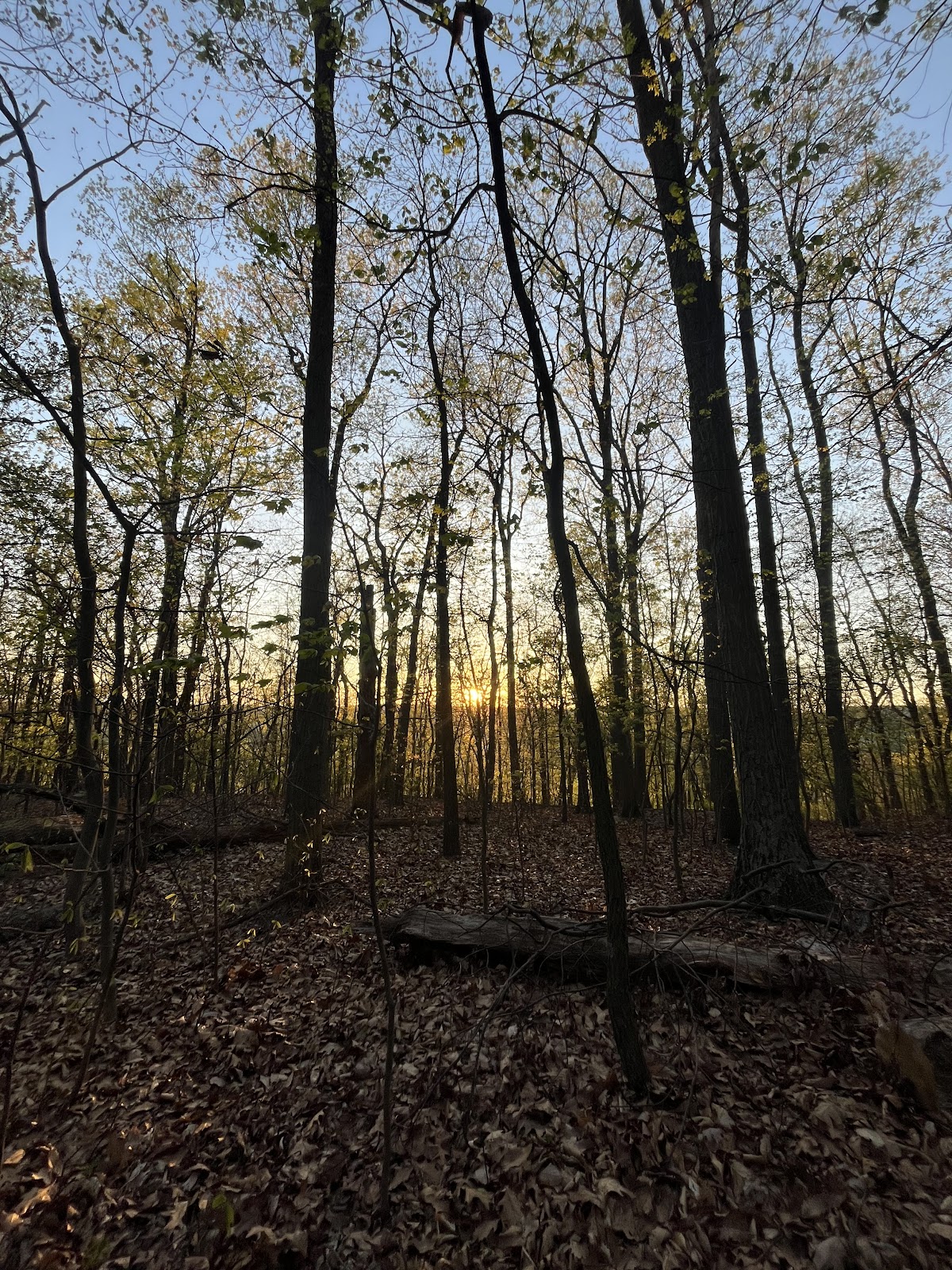
As we headed south back into Maryland, the sky was beginning to light up. The first section of the Appalachian
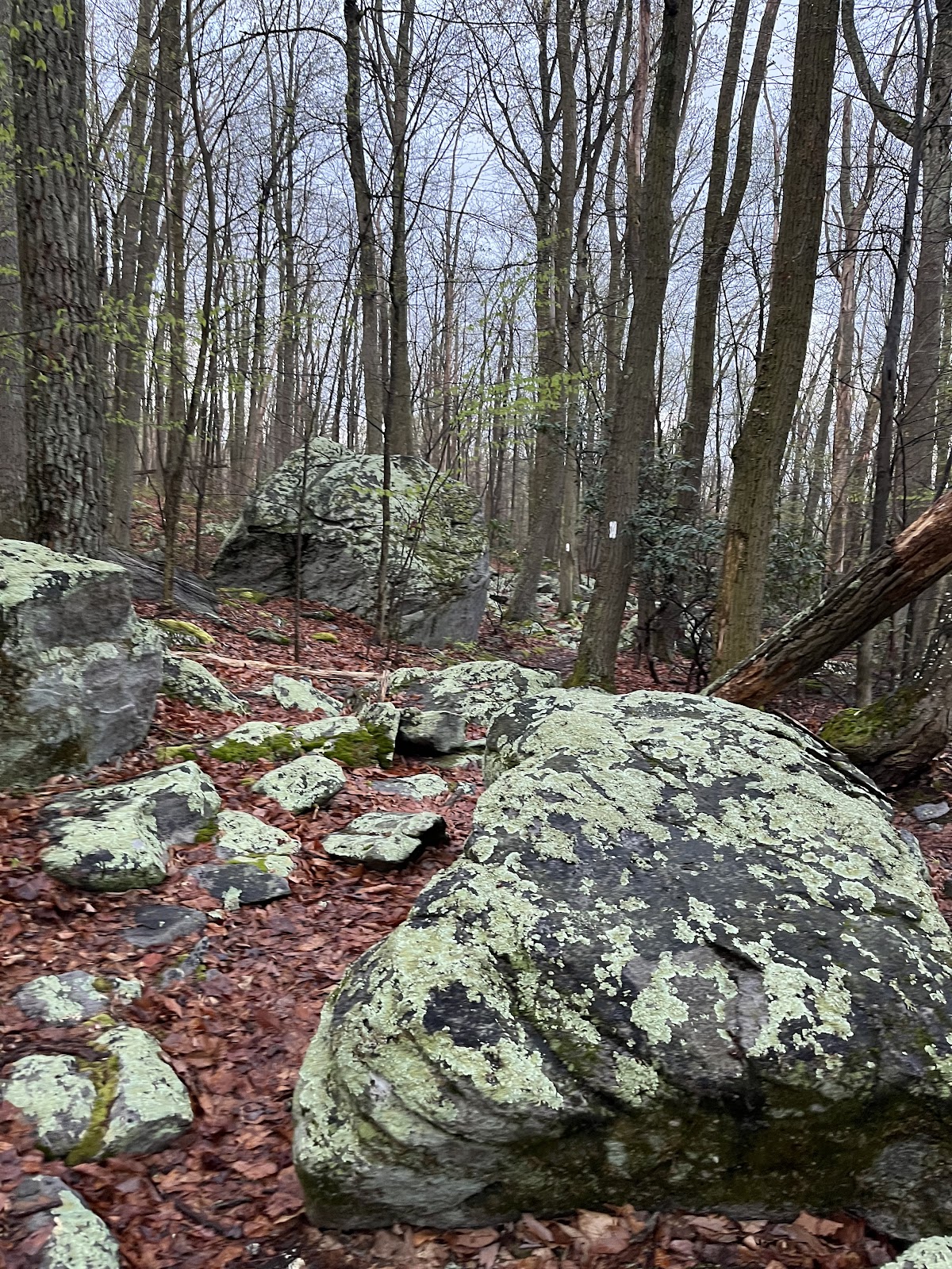
Trail in Maryland is incredibly rocky - foreshadowing of the many rocks to come.
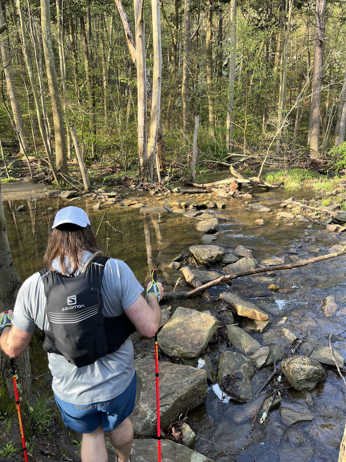
Heather had already run 50 miles the two days leading up to this adventure. Heather, Dylan, and Josh all carried
poles, while Lori and I were freewheeling it.
There were quite a lot of people out on the trails even this early in the morning. We climbed up to High Rock, and
it was UP. It would be the highest climb of the day at 1900’ ft elevation.
There was a woman with a beautiful AT tattoo on the back of her left calf. I told her as we passed along the ridge
at High Top. She proudly responded in a British accent, “Thank you so much. I got it after hiking the AT twice.”
What an accomplishment! Every time I hike along the AT, I question how people have the grit to do it day after
day after day…
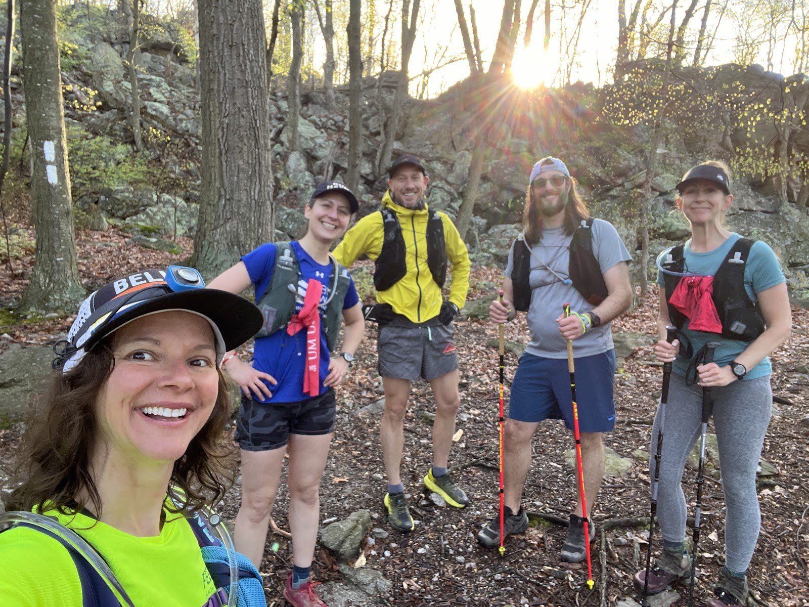
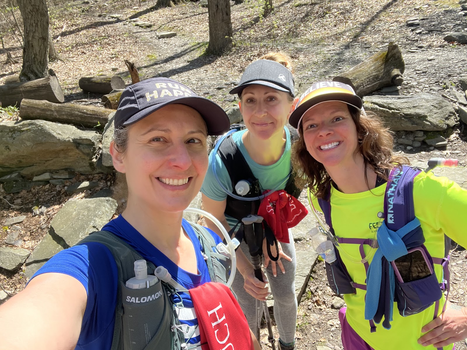
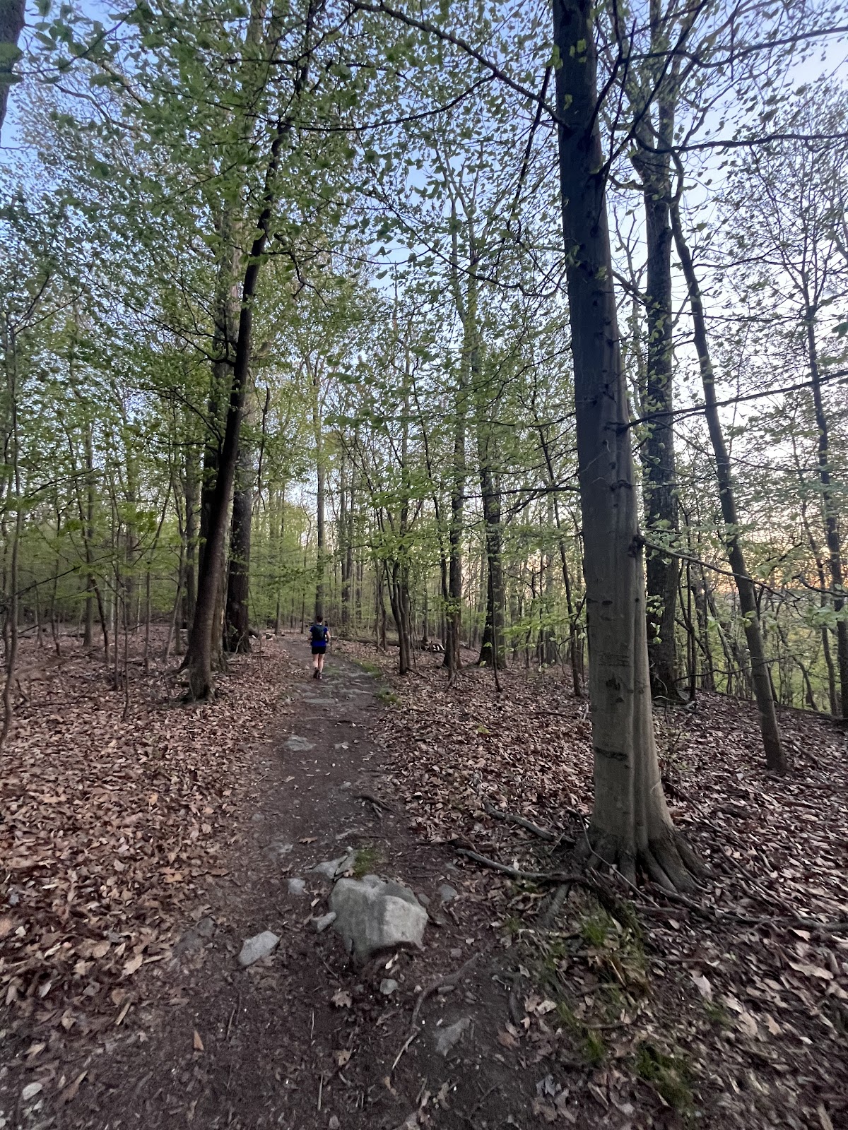
We paused, ate some food, took a selfie, and carried on. Our pace was mellow. Traversing the first 8 miles was up
and down, over large slippery rocks, and we all stayed fairly close together.
We reached our first and longest stream crossing, which I don’t recall from last year. Most of us took our time
crossing over slimy rocks. Dylan being the only one that ended up walking straight through it.
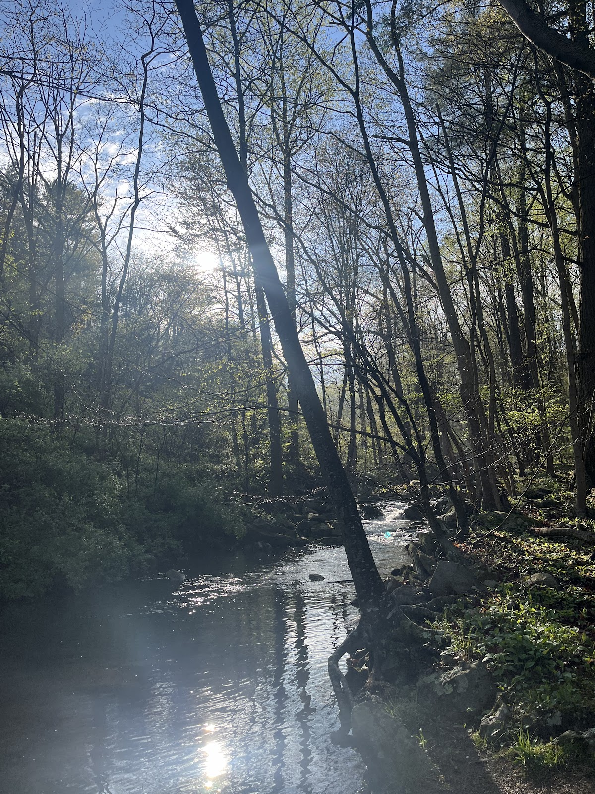

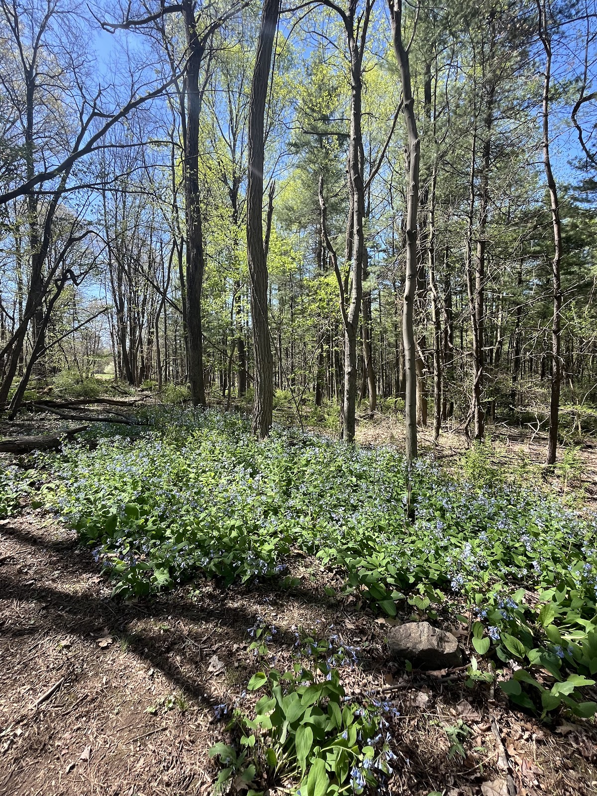
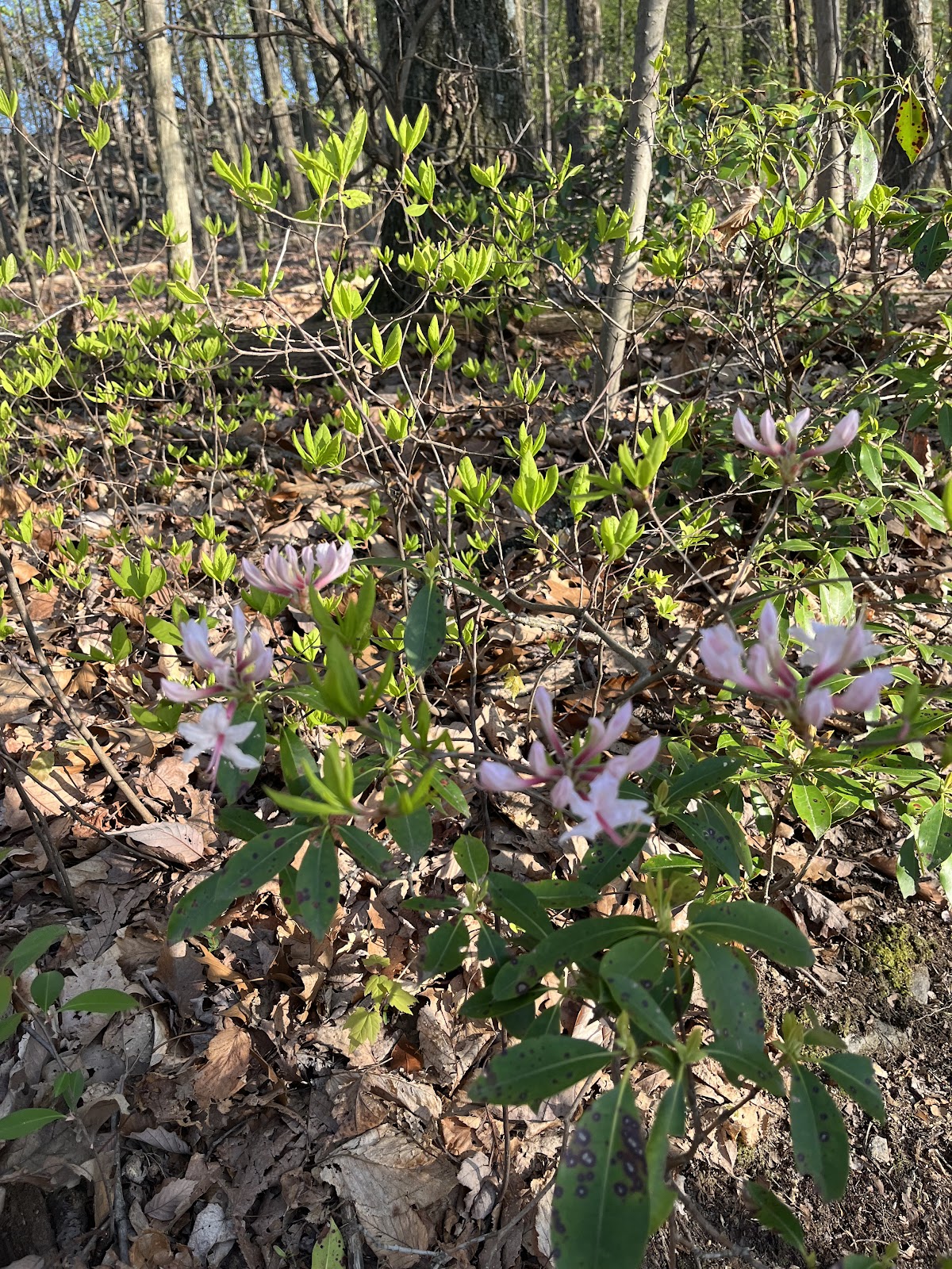
As we fell into our own rhythms, I soaked in all of the nature, that was all around us. The sun beaming in through
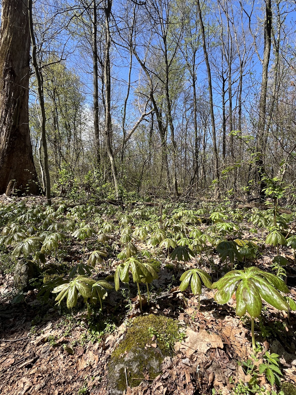
the trees made the spiderwebs glisten. The floor of the forest was blooming full of green, large leafy mayapples.
The lime green moss on the rocks stood out vividly amongst the dark brown bark from aging trees. Every now and
then I’d hear a spring over the loud cars that buzzed close by.
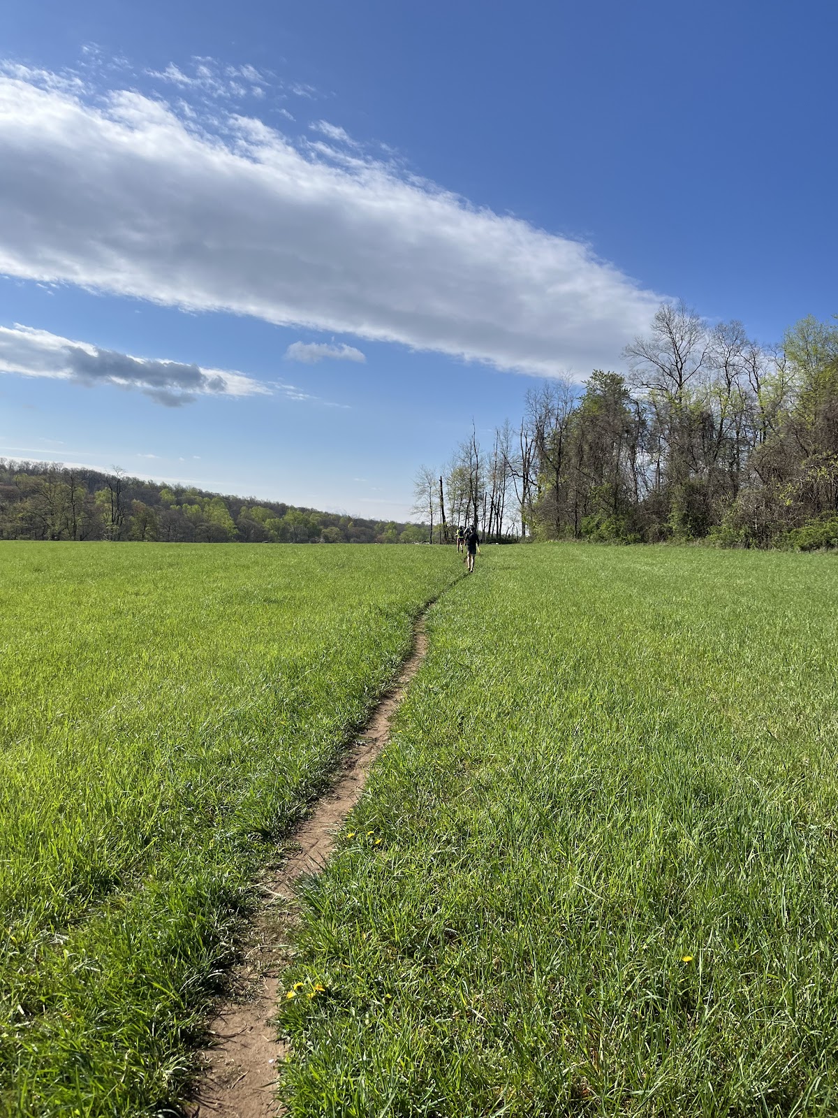
This section of the AT is so great because it is so accessible but not very remote because it is so accessible. It takes a
little effort to block out our human-made noise.
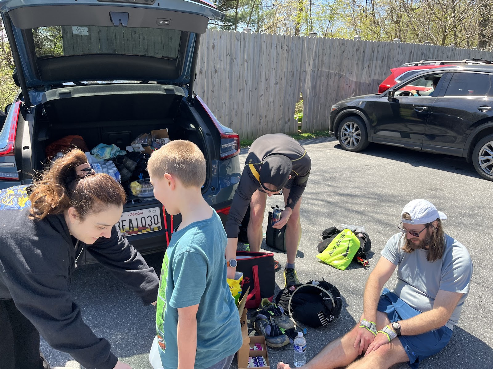
Our next destination was to meet Megan at the parking lot in Boonsboro at mile 19. First, we would summit another
2 mountains including Black Rock. Dylan and Josh began to take the lead. Heather, Lori, and I stayed together and
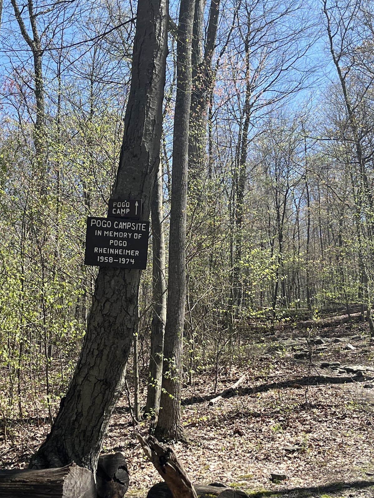
chatted about upcoming adventures, family, life. We came across Pogo camp and saw a sign that alluded that it was
in memorial of “Pogo Reinheimer 1954-1978."
I gave a moment of silence and wanted to learn more about Pogo and other named shelters along.
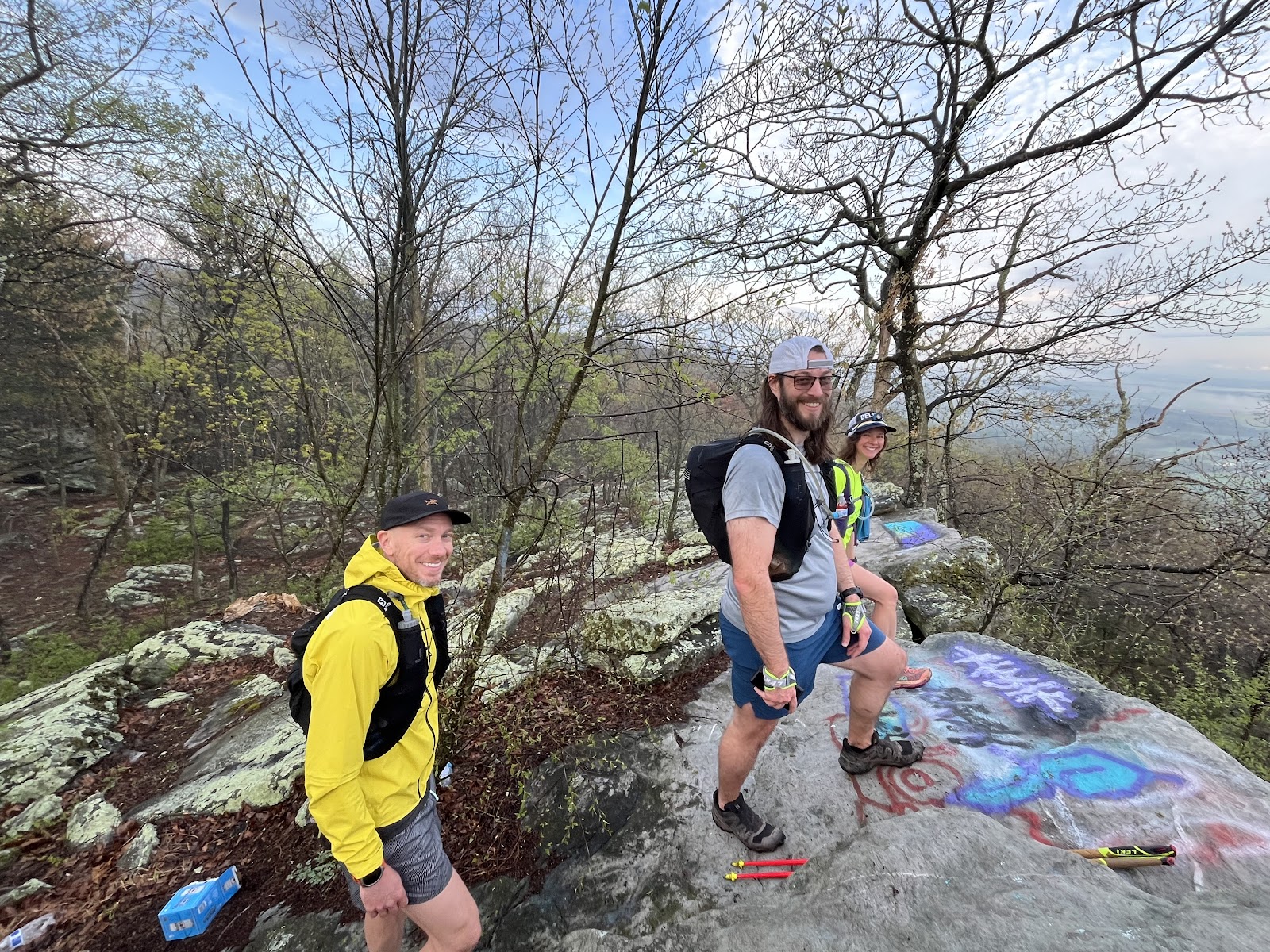
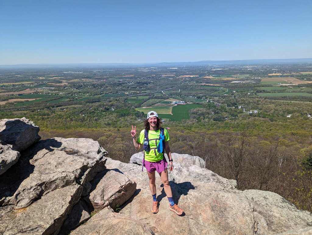
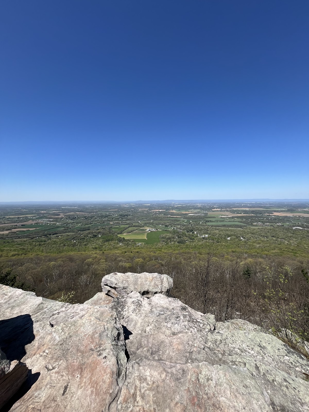
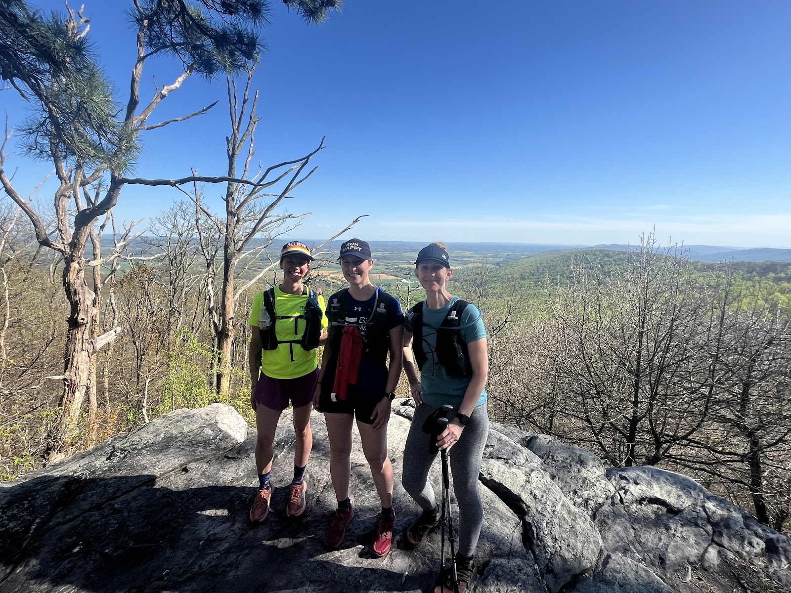
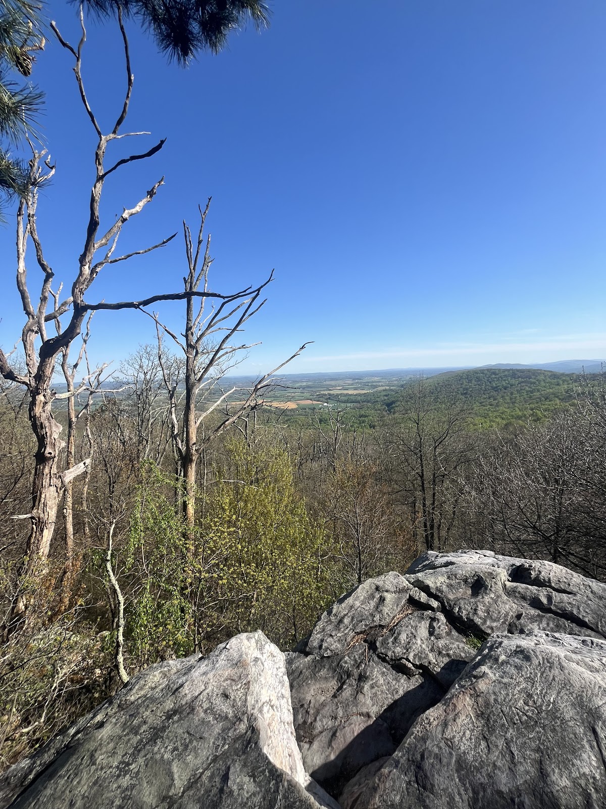
Black Rock had stunning views and didn’t require us to travel too far off the trail to enjoy. We caught up with
D&J, ate and took a few pics.
The trail was busy with people out enjoying this lovely day. We headed down to meet Megan for some refilling
and refueling.
When Heather, Lori and I had reached the lot, D&J were snacking. Megan and her boys were eager to help us. So
incredibly sweet of her to do this for us weirdos!! I filled my hydration pack, electrolyte bottle, ate some fresh
pineapple, Salt & Vinegar chips, a smushed PB&J from my pack and an apple sauce. We felt recharged!
D&J said they were going to get back into their groove. They had planned to run a bit further than us to VA and
wanted to try to reach there before dusk. That actually was a relief - it meant we wouldn’t have to stress about
holding them back.
We said farewell and thanks to Megan and the boys and headed towards Washington Monument. We had 3 miles
to go.
I can’t lie. It felt like a very long 3 miles. There weren’t many runnable sections in between. After having Megan
to look forward to at the halfway point, it felt like we were starting all over again.
The sun was warm and I felt like I was probably getting a sun burn. The smell of manure also returned. It was
likely from the dairy and cow farms from below. At first, I thought it was me 😳
Once we did reach Washington Monument there was lovely site - a blue sign that read “WATER.” we just filled
up our hydration packs but topped them all off. This would be our last opportunity to do so. The water tasted
“minerally.” It felt great to splash that mineral water on our face and our hands and the backs of our necks.
Next Stop: Gathland
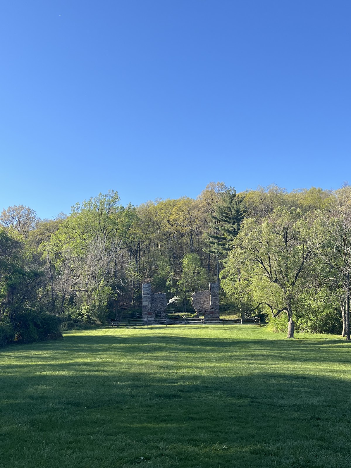
Gathland was a milestone for me. It’s where I called it quits last year. I had memorized nearly every mile in
between here and there.
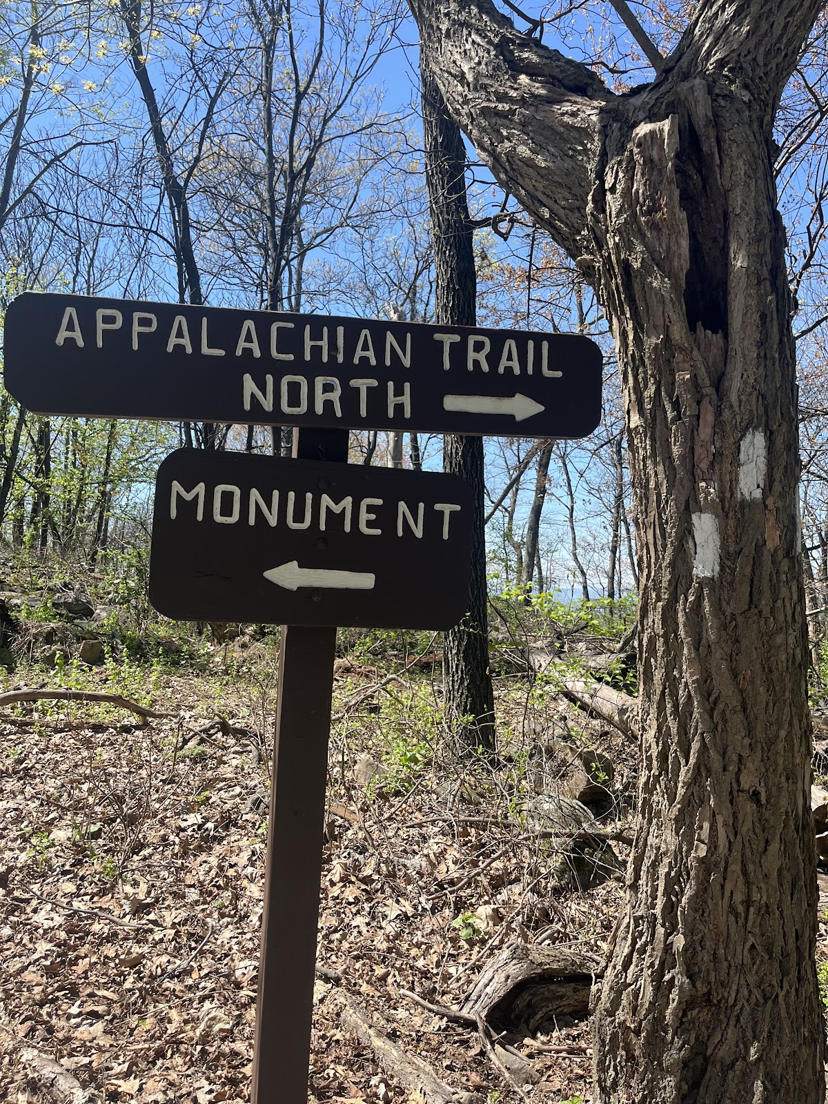
When we popped out onto a road with memorials for two soldiers from the Civil War, there was a gentleman who
clearly was packed for many days of hiking and camping looking a bit lost. I told him the SoBo AT was across the
road and pointed to it. He looked a little out of it, but said thank you.
We tried to keep our distance from him, but it was a little difficult because he kept at our steady pace. Eventually,
we decided to pick it up and move ahead. As we passed him, he said to me “I’m just trying to get to Tennessee
want to join me?”
“No, thank you, Sir. We are not traveling nearly as far. Have a safe journey.”
Heather laughed when I told her what he said. “He was looking for trail nookie?!” We all laughed.
We reached Turner’s Gap, a historically significant landmark with the oldest restaurant in Maryland, Old South
Mountain Inn, and the Church of Saint Joseph and the Sacred Heart of Jesus. Also, Dahlgren Campground for
Hikers with very clean bathrooms that are open 24/7/365. Thank you to all for these sacred facilities.
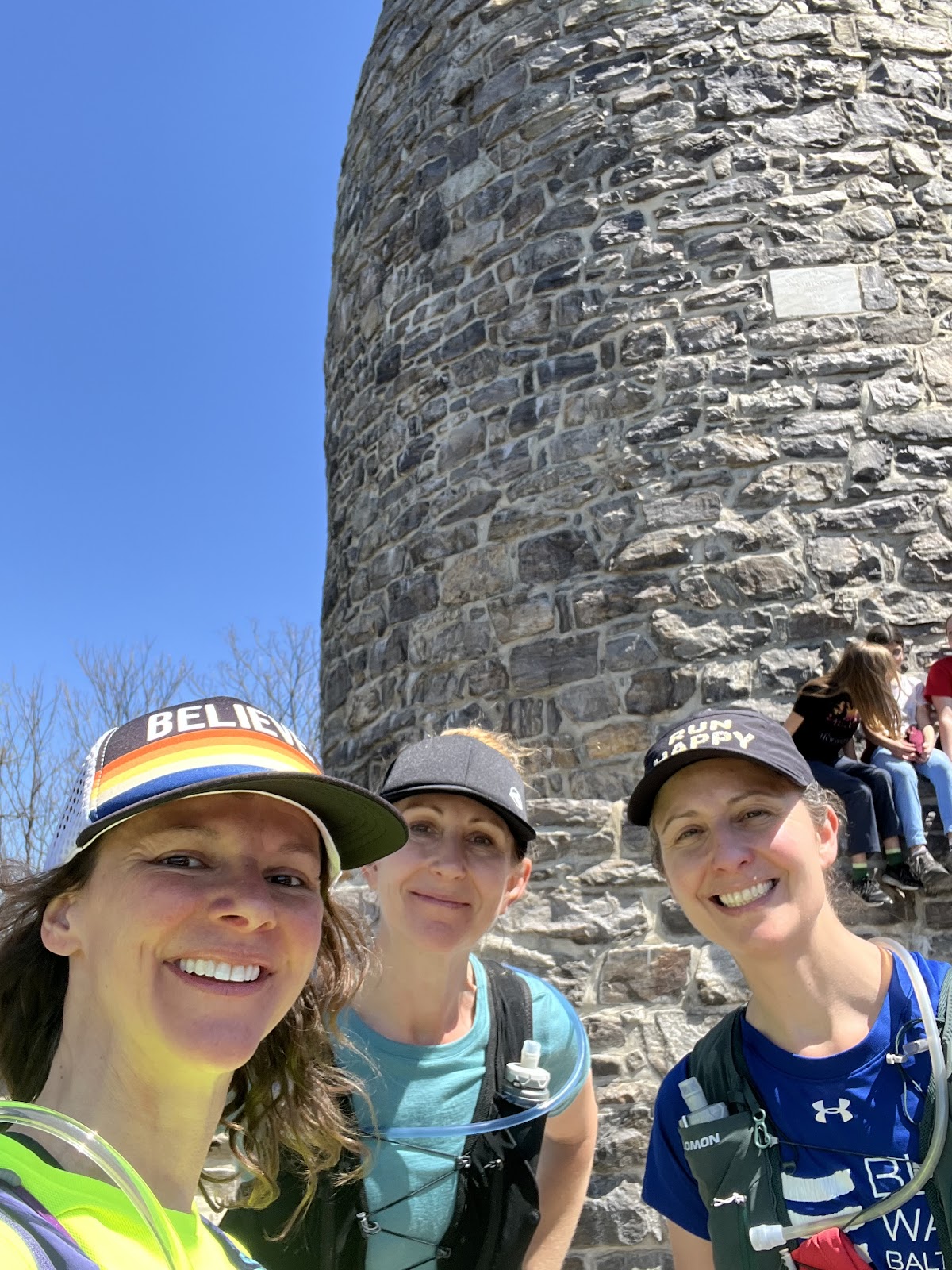
We made our way up to White Rock, the last lookout of the day. A few people were taking pictures and offered to
take ours.
The next stretch along the ridge was finally runnable. We shuffled along until we began to descend into Gathland.
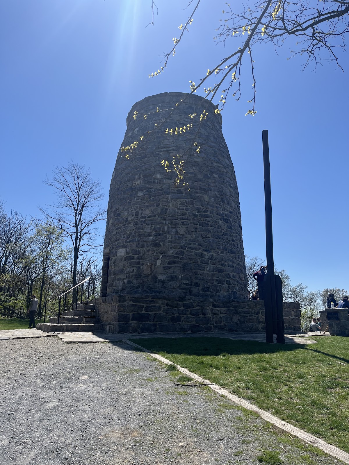
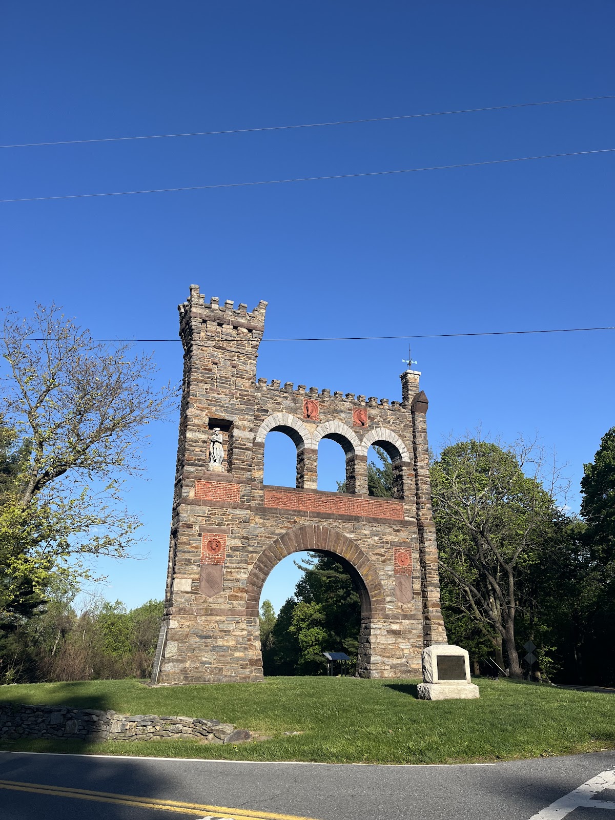
6:00pm (12 hours)
The stone facades peeked through the trees and I had never been happier to reach this milestone. I waited a
moment for Heather and Lori to greet the gates of Gathland together.
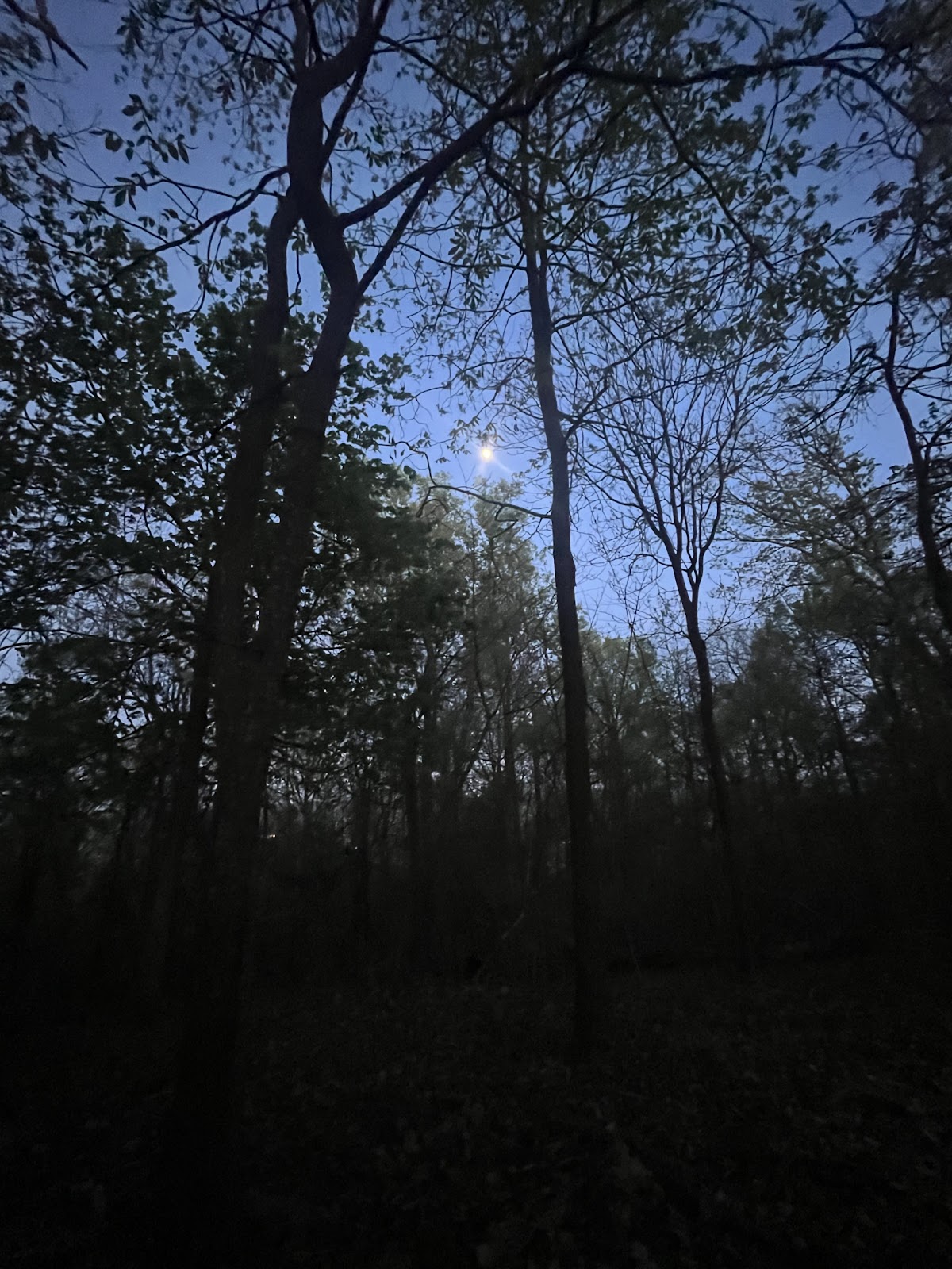
The moon was beginning to show off her fullness behind the monument. We met an overnight hiker and his very
handsome white dog, Ghost (trail name) or Juno (real name). We didn’t catch the gentleman’s name. We took a
photo of them with the gate and continued on.

After talking through what would have been a pretty grueling final 4 miles into Harpers Ferry in the dark, we
decided we were going to end our journey at Weverton Cliffs. Nick was our picker upper. I texted him an ETA and
pin of the parking lot.
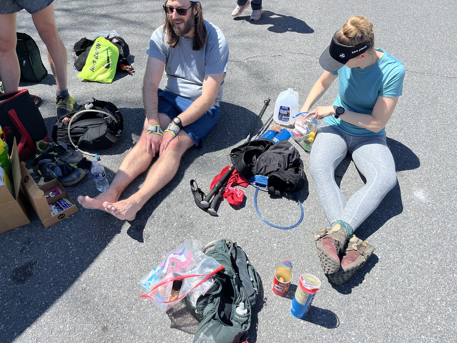
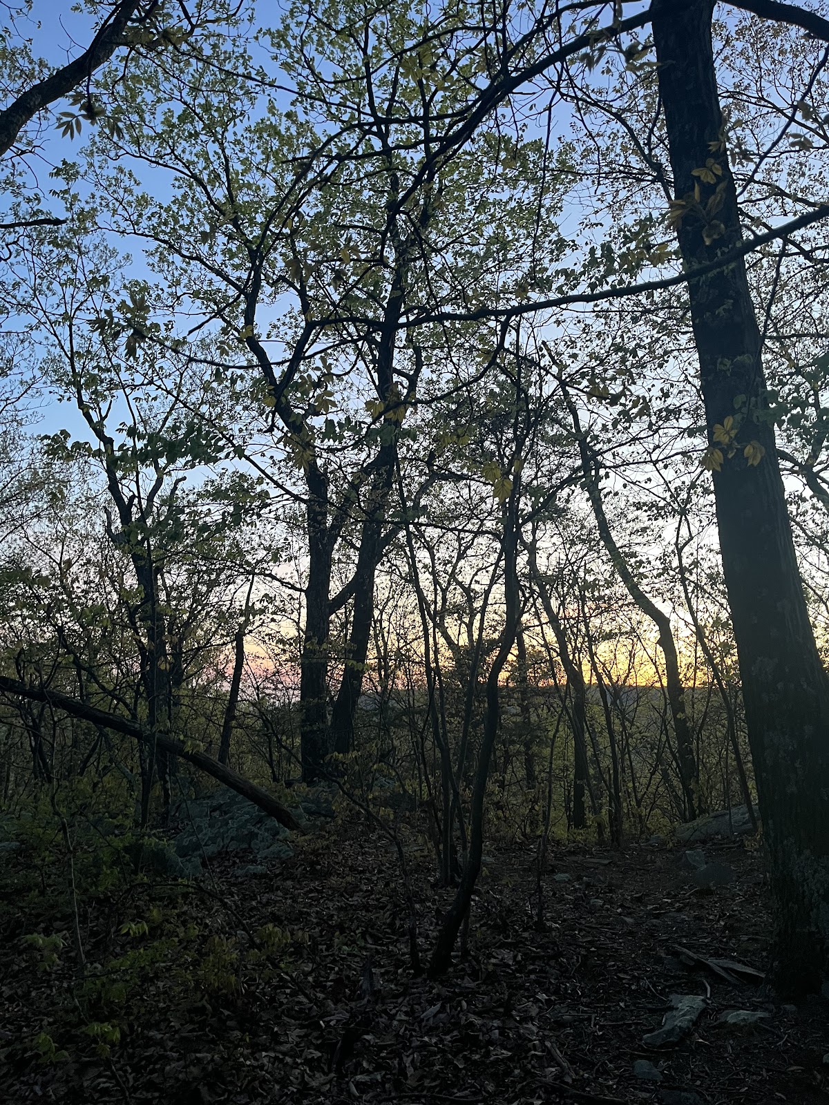
With 8 miles to go, we only had about an hour and a half before the sun would begin to set over the mountains to
our west. We would pick up the pace on any sections that didn’t have rocks.
Heather spotted a ring-necked snake just before she stepped foot on it. I had never seen one and trying to get
acquainted with snakes and other creatures, I took a closer look. It was pretty and that says a lot coming from me.
Our headlamps were back on and conversations picked up. I think we all felt relieved that we knew we could
make it. The traffic along the trail died down as people were settling in for the night in shelters or tents.
The moon was full directly above us. I pointed it out to Lori. Without any pause, she said, “let’s do something
witchy!” I laughed. Spirits were higher now that we knew we just had to get down from this mountain.
The wind began to pick up and it was getting chilly. We shuffled when we could, mainly just to warm up.
With our headlamps on, bugs were flying at our faces. We joked that we probably got some protein from eating
them all day. It was very buggy out there for this early in the year. I also saw some other wildlife in the final miles.
Eyes glowed as I looked down and out. Bright green spiders, beetles, a fox or 2 in a den, and … other hikers with
headlamps.
The switchback down from Weverton Cliffs to the parking lot seemed to go on forever. The rock steps were
becoming trickier and my legs heavier.
When I stepped foot out of the woods onto Weverton Road, I felt so exposed. My first reaction was to go back
into the woods. Nobody gets me out here.
Then I came to my senses. Nick was waiting for us with water, towels, heat and willing to take us anywhere to eat.
Bless him.
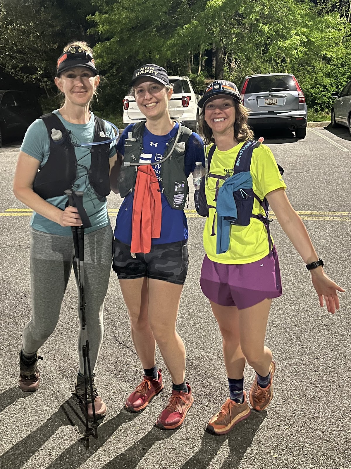
Our watches all said slightly different distances but we all had to round up. So, we circled the lot as Nick stood
there thinking who knows what? We hugged each other and slowly took off our trail gear, climbed in the car, and
searched for the closest Burger King.
When we couldn’t find one in the remote towns we were driving through, that we had ran alongside, we opted for
a Sheetz instead. I should have eaten something but couldn’t stomach anything.
Nick dropped us off at my car in the dark parking lot. We peed outside for the final time and headed back to the
real world.
Last May when I ran this, I was training for CAT50k and Twisted Branch 100k and felt much more in shape. This
was purely a test of endurance not speed. Truthfully, I wanted to spend as much time as possible in nature with
friends soaking in the beauty of spring ✅
Lessons for next time:
Sunscreen/chapstick with sunscreen
Bug spray
Aide station in Gathland (water and hot food/real meal)
More Gu and electrolyte drinks
Comments
Post a Comment